 magyar
 english
 srpski
 slovensky
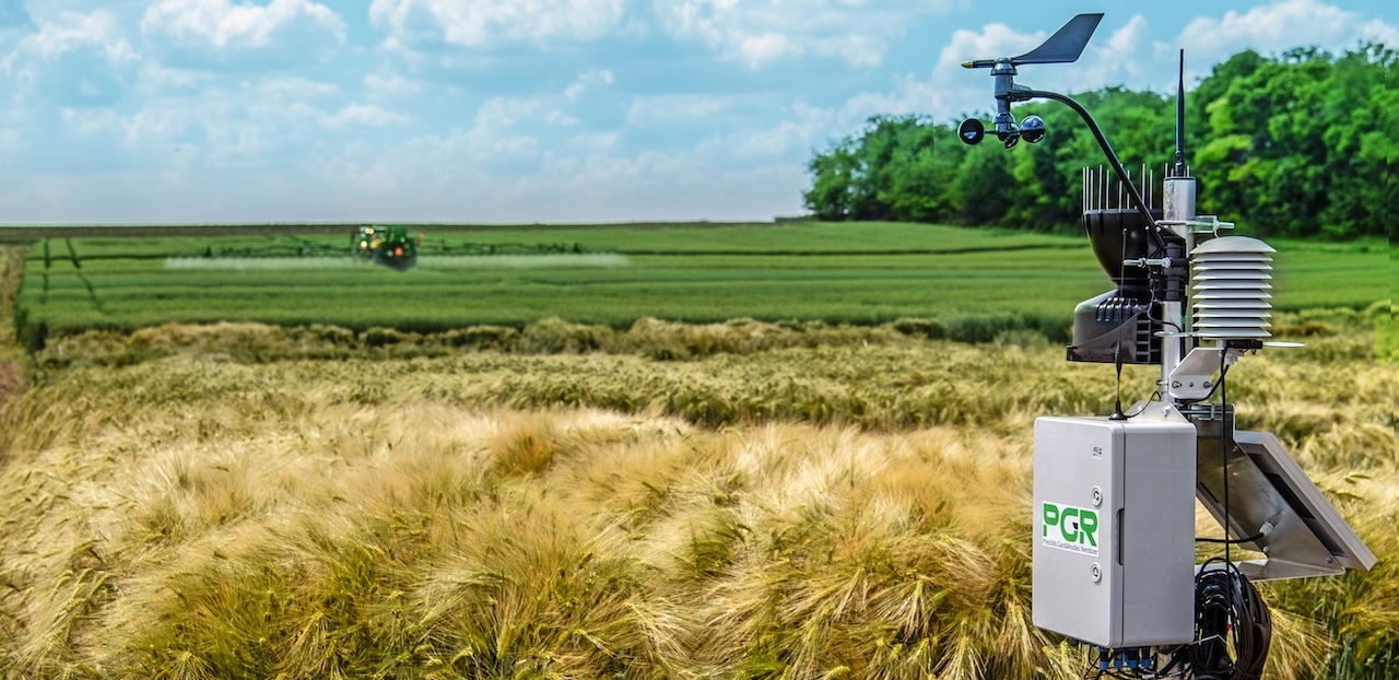
The data that all farmers want to know
For precision farming, it’s essential that farmers use site-specific data relating to their particular field. One such important piece of information is a locally measured meteorological data series. In 2017, KITE set up an agrometeorology station marketed by KITE, and there are now hundreds of these stations operating around the country.
The stations enable us to measure the most important parameters in agriculture:
- soil moisture at several depths
- soil temperature at several depths
- relative humidity of the air
- air temperature
- global irradiation
- wind speed and wind direction
- precipitation
- leaf wetness
Naturally, these stations can also be individually configured in line with the needs of the farmers. The station has a separate battery and solar power supply to ensure continuous operation all year round. Its central electronics have been designed so that it can operate as a router for radio data collection sub-units, known as nodes, with which measurements can also be made in the microclimate of the field.
The devices have been developed so that each sensor is uniquely identified, and the station automatically recognizes which sensor has been connected to it, thus ensuring that the system can be installed very easily, without significant expertise.
KITE provides its partners with a nationwide service and, in order to keep the farmers’ equipment safe, the stations are equipped with theft alarm and tracking systems.
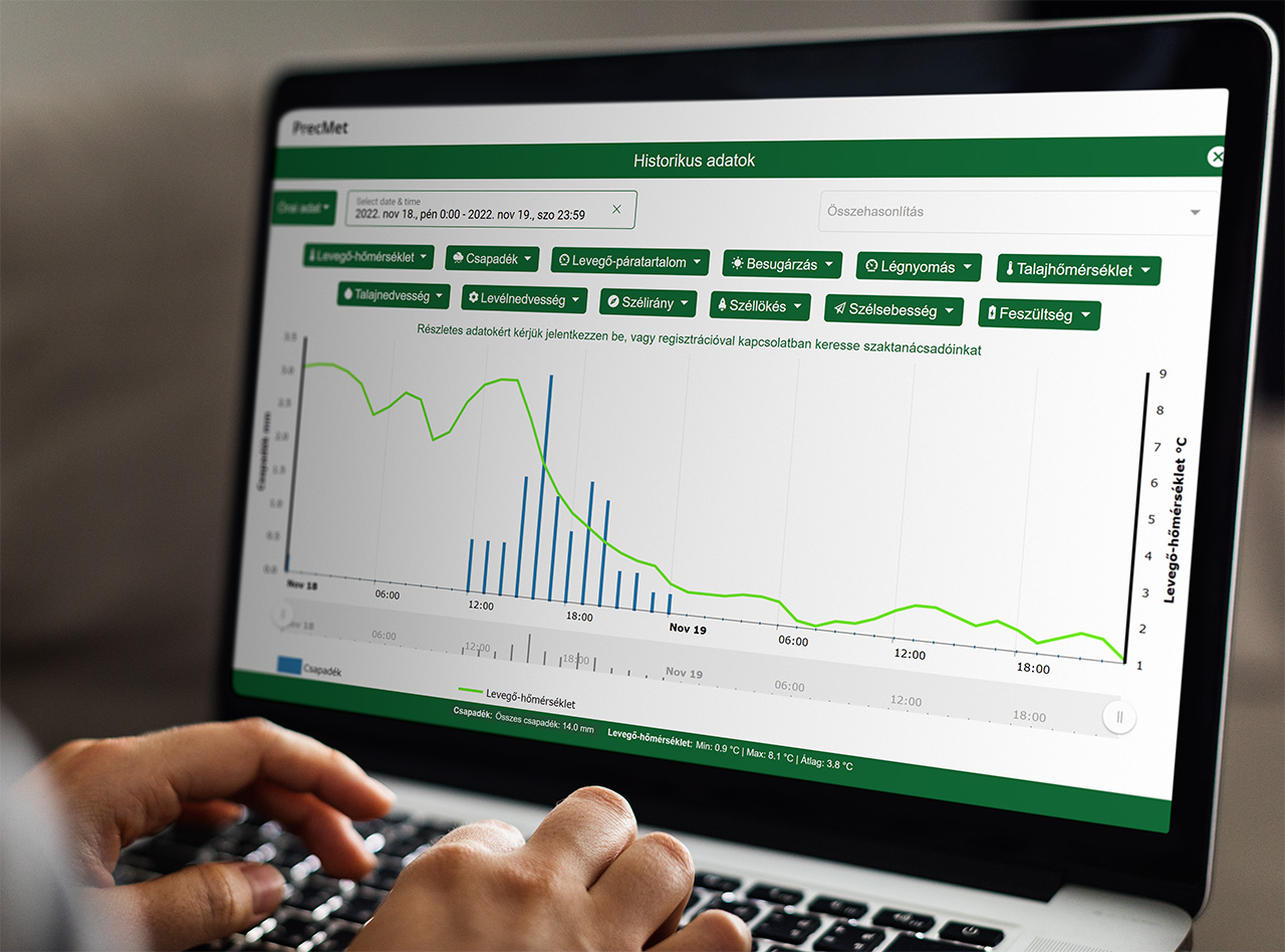
In the Agrometeorology app, the data measured by the agrometeorological stations can be displayed in a time series chart, in a 10-minute, hourly or daily breakdown. Registered partners can download the historical data of their own station going as far back as they want.
Agrometeorology on your mobile
To ensure that the data you need are always at hand!
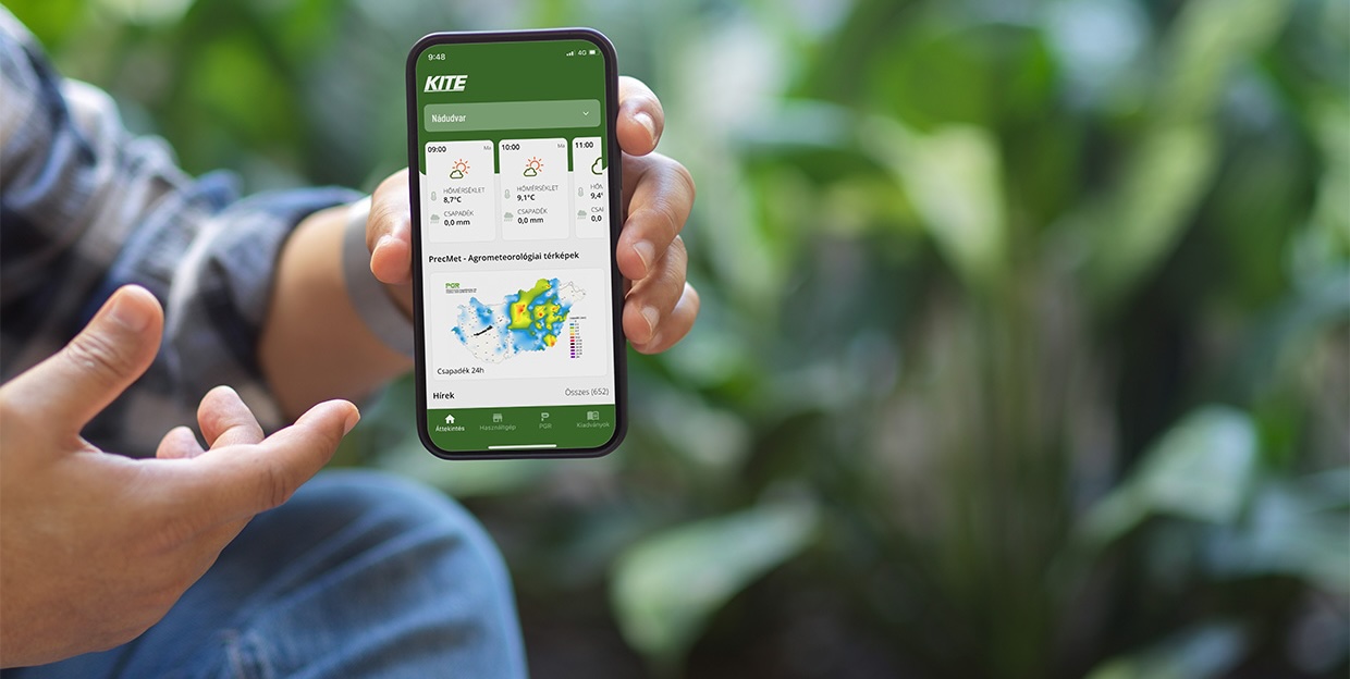
One of the most visited apps of KITE’s Precision Farming System is Agrometeorology, which provides meteorological data.In fact, the app can be used for all farming activities where knowledge of the latest weather conditions is essential. So that users always have meteorological data at hand, this information is also available on a mobile app. Users can select their own favorite station, so that when they open the app, they can immediately see the data from that station. To improve our partners’ user experience, and so they no longer have to enter the app to access the data of the station they’re most interested in but, instead, can see the key data immediately on the main screen of their phone, we’ve developed a widget for the app.
To improve our partners’ user experience, and so they no longer have to enter the app to access the data of the station they’re most interested in but, instead, can see the key data immediately on the main screen of their phone, we’ve developed a widget for the app.
- 24-hour precipitation map
- heat map
- plant protection wind speed map
- wind speed map
- soil temperature map (weekly average)

Map-based visualization supports effective farm management, providing up-to-date information on the executability of various agronomic operations, including
- whether the soil temperature is suitable for planting
- whether there is a risk of frost in the plant population
- whether plant protection activities can be carried out
- whether spraying can be performed given the latest wind speeds
- where the rainfall zone is, and whether it is even possible to go out in the field to work
- basic data for irrigation scheduling
Our related services
- Sale and renting of agrometeorological stations
- The agrometeorological data service is available via desktop computer and on a mobile app
- Agrometeorological daily maps