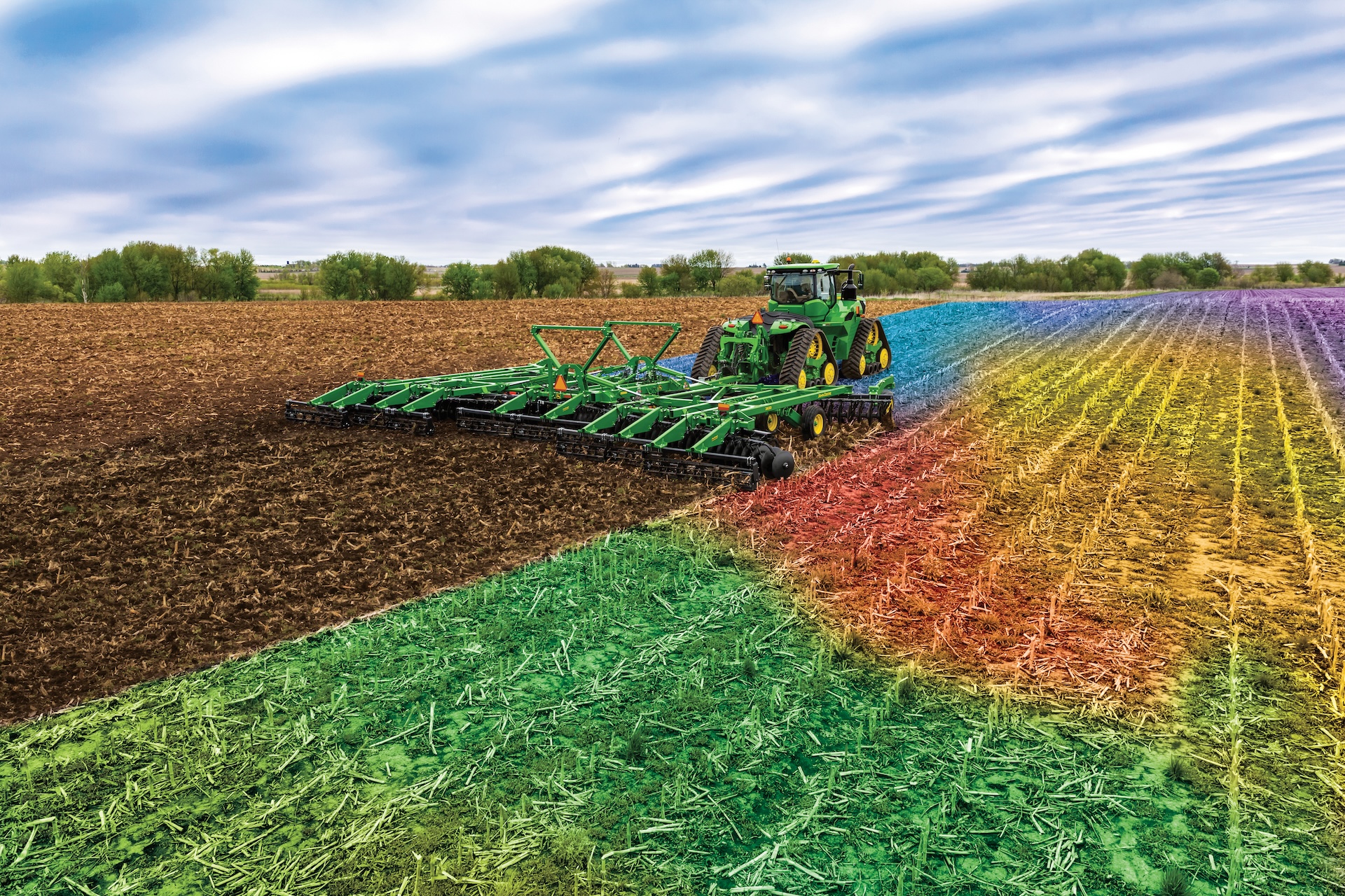
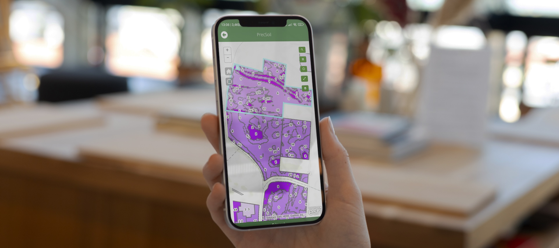
KITE is at the forefront of soil analysis in Hungary. Soil analysis is the basis for good farming practice and input materials management, so it is important to define the exact locations of soil sampling and to identify them clearly, both spatially and in the database. We have therefore developed our own soil sampling units, which are capable of taking soil samples and transmitting the data online. The Soil Sampling app is the final element of this process, where the sampling trail, sampling points and soil analysis results can be displayed, compared, and downloaded.
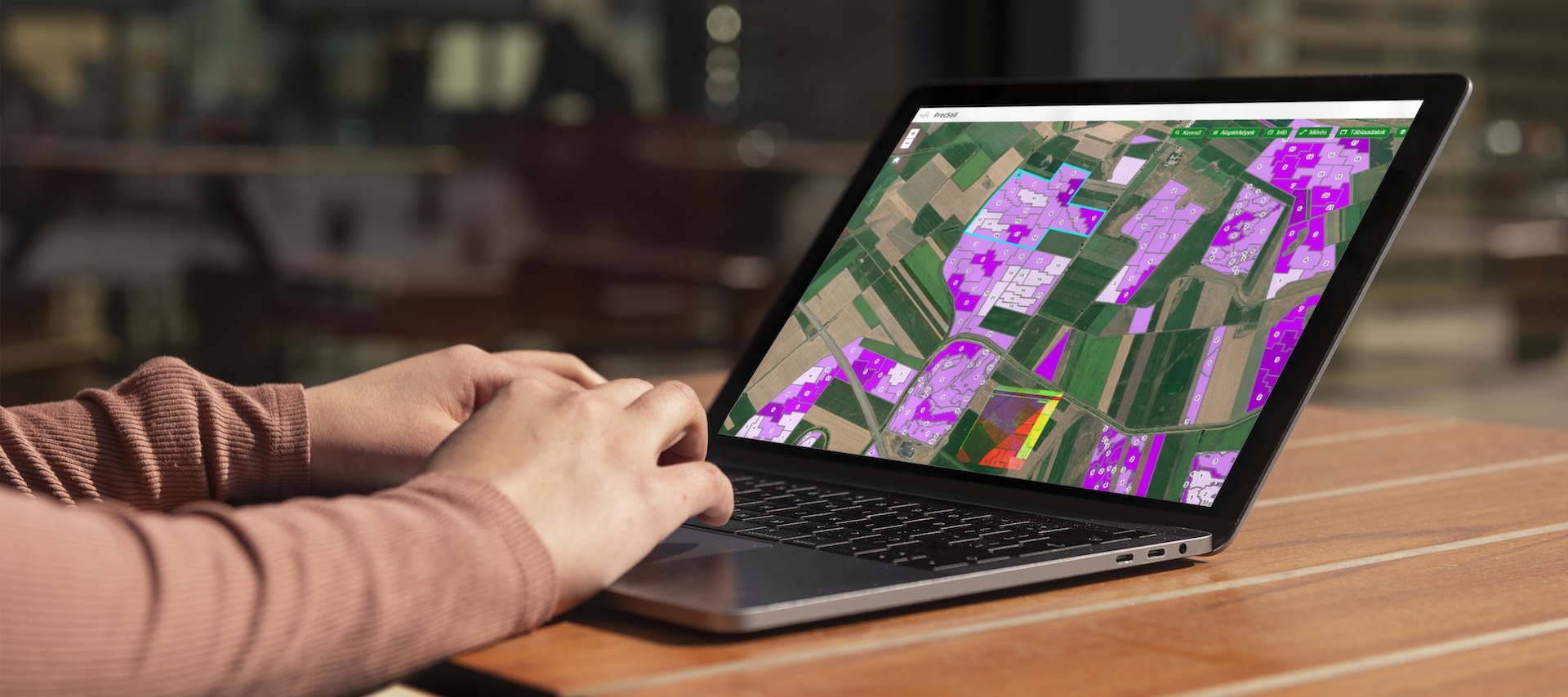
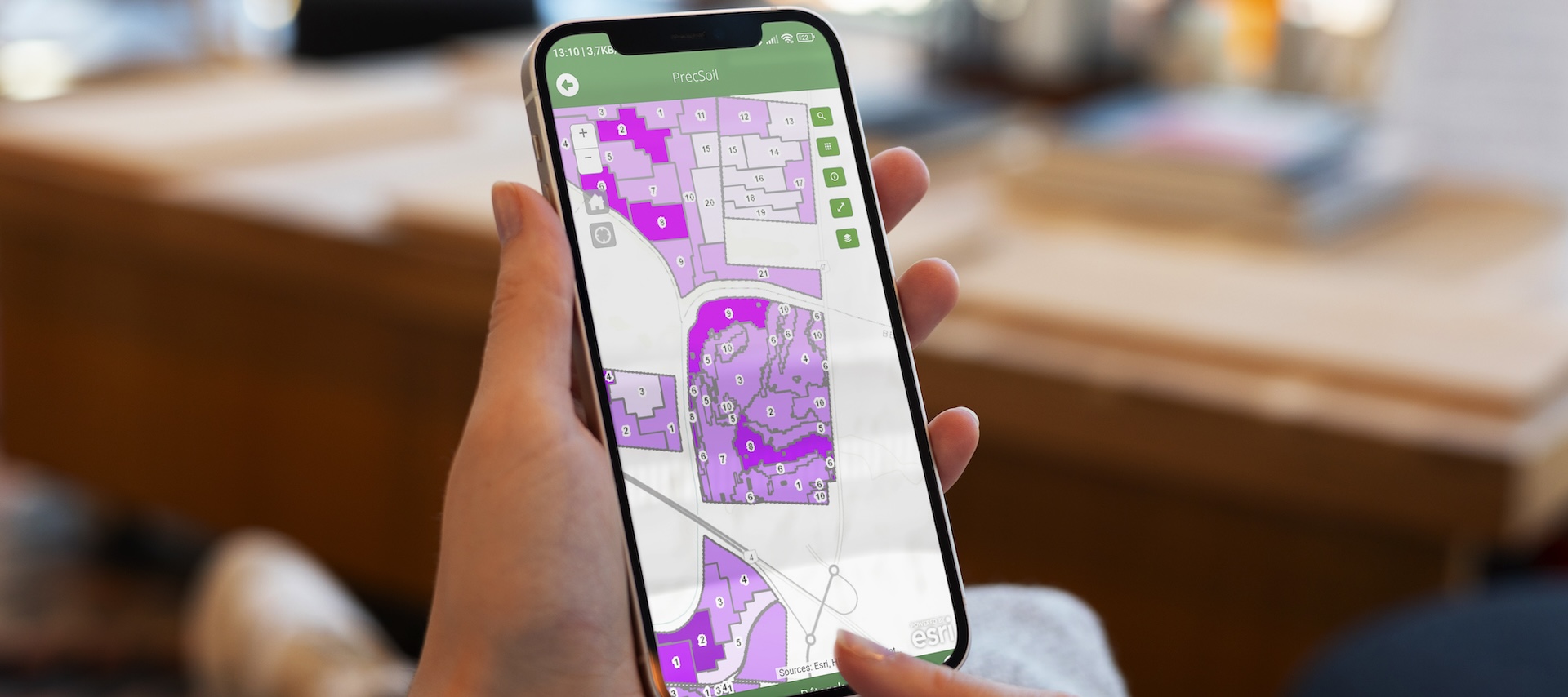
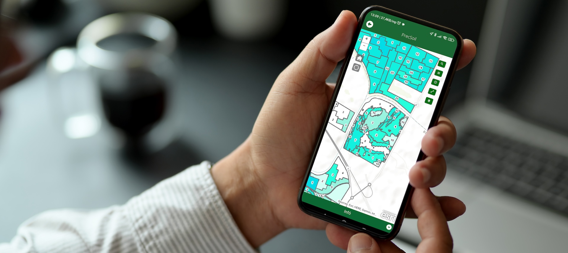
The app allows you to view your fields and their zone maps, as well as the productivity map of the area. On the map, you can track the status of soil sampling, with warning colors indicating areas where the soil analysis is about to expire. When soil sampling, you can conveniently monitor the real-time work of the soil sampling vehicles from anywhere in the world, even from your mobile phone. You can view the sampling routes of the vehicles and the exact location of the sampling points in each zone. The app allows you to view the physical and chemical parameters of the area measured by the laboratory in both map and table format. It is possible to select and compare supply data for the fields and to download the data.
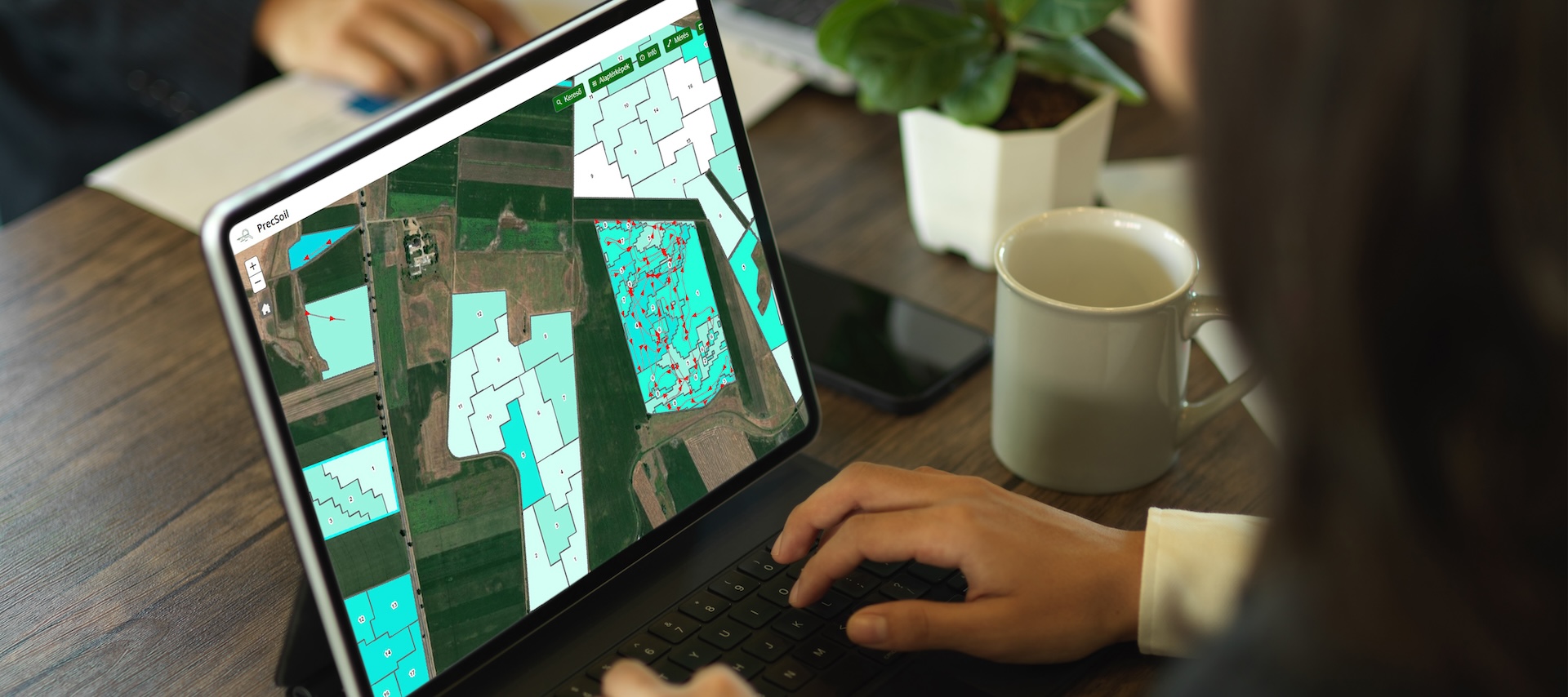

The app also provides an option to upload data from external sources. The app can display in real time the route of the vehicles, the location of the sampling points, as well as the time and status of the sampling.
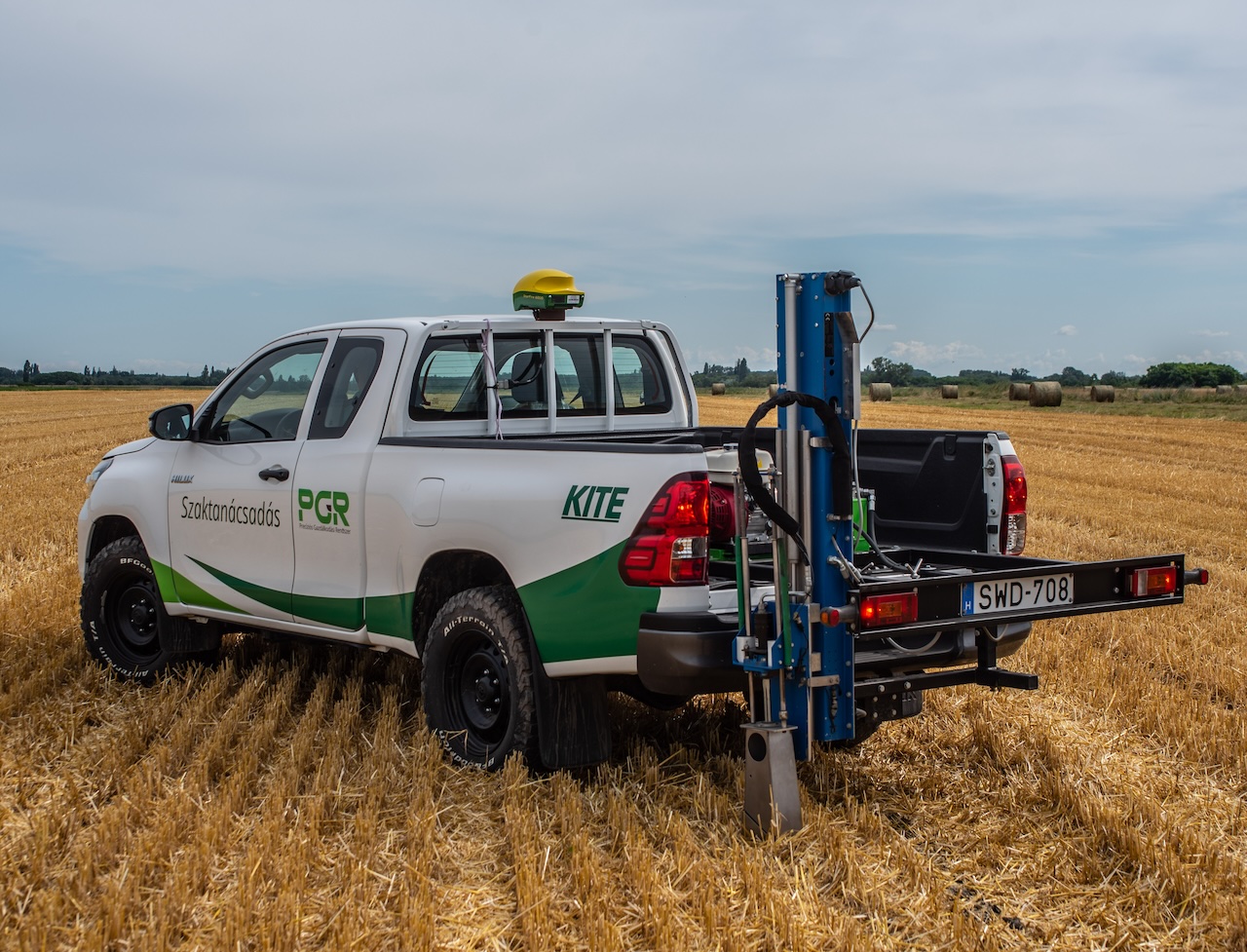
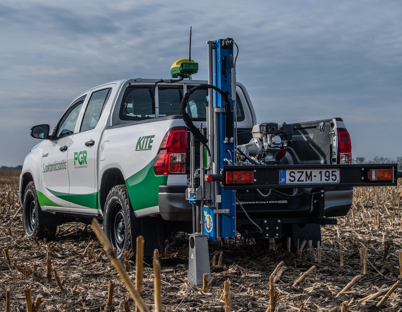
KITE has its own fleet of soil sample vehicles for collecting soil samples. All soil sampling vehicles are equipped with automatic sampling units that take samples from the top 30 cm of soil. The vehicles receive the zone map online. The sampling route is documented every second and the 20-25 sampling points per zone are sent directly to the PGR. The vehicles are equipped with John Deere receiver, which allows the sampling to be documented with a very high degree of accuracy. Sample tracking is assisted further by the fact that the vehicle is equipped with many control functions and the sample identification label is printed fully automatically.
Real-time monitoring of the soil sampling process via web and mobile platforms.
Display of data on your own land in map and table format.
There is a possibility to compare field data within the farm and to download them.
 magyar
 english
 srpski
 slovensky